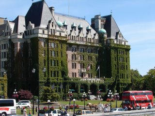
Friday, July 21, 2006

Highway 37 to Dease Lake

Hi again all - So, after my visit to Stewart/Hyden, I travelled back along Hwy 37a to Hwy 37 and continued north. I've been seeing a lot more wildlife on the roads because I've started to drive after 6pm, when the animals come out. It doesn't get dark in these parts until midnight or so, so I've got plenty of light to drive by. Here are some shots along Hwy 37 heading up to Dease Lake:


A black bear posing for me.


Great scenery for much of the drive.


A postcard for you...


Hodder Lake rest area. This lake breathtaking!

I actually pulled over in a gravel parking lot on my way to Dease Lake to spend the night. It was a little weird being all alone, not knowing if anyone would come a knockin. No one did, and I got on the road in the morning with no problems.

Friday, July 14, 2006

Stewart, BC and Hyden, AK

After I left Prince Rupert, I travelled back along Hwy 16 heading east and took Hwy 37 north. About 90 miles into Hwy 37, there was a turnoff to Hwy 37a to Stewart, BC and Hyden, Alaska, which is only about 2 miles past Stewart. Really small towns here. Very nice! Hwy 37a is known as the glacier highway, for obvious reasons. It was a really great drive to Stewart:


Saw this guy along 37a


One of the highlights down here is a 25 mile drive up to Salmon Glacier. Here are some pictures of that trip:


Here are a few shots of the area around Stewart/Hyden:


There's been a lot of rain and cool weather up here. They consider it a rainforest. No doubt!

Prince Rupert

After Smithers, I drove along Hwy 16, heading west, until I got to the town of Prince Rupert, right on the coast. The drive to Rupert was really beautiful, with the road hugging the very large Skeener River. Very nice! Not a whole lot in Rupert, but they did offer a seaplane over to a bear sanctuary, called the Khutzeymatee Bear Sancuary, located up through the mountains, about a 20 minute plane ride. I decided to check it out:


When we landed, we were put aboard a zodiac, and went to check out the grizzly bears. We saw a total of 7 bears, including a mom and three cubs:


We also saw a few bald eagles out on the zodiak:


It was a really great experience! I did a short hike the next day, near the coast. Didn't see any animals, except this giant slug:


Here are a few shots I took along the highway, leaving Rupert:


Thursday, July 13, 2006

Smithers, BC

Drove along Hwy 16 and stopped at one of the Provincial Parks along the road. It was a really beautiful park, with lots of flowers.


Continued along Hwy 16 until I came to a town called Smithers. It was a really beautiful place, with lots of hiking. I stayed in a place called Glacier View RV Park, just north of town. As the name suggests, it had a perfect view of a glacier up on a place called Twin Falls. here's a shot of the area:


I drove to the falls, took a 5 minute hike to photograph the two falls. Very nice! You can see all of the pictures on my photowebsite at www.tomsphotosonline.com. Anyway, I then started hiking this trail called Glacier Gulch. It climbed steeply through rainforest, and I hiked about 30 minutes when I met up with 3 other hikers who told me to keep going 2 more hours, where the trail would lead me right up to the glacier! I didn't have any food or water with me, but decided anyway to follow them up. Another half hour later, they stopped where the "trail" became nothing but loose, jagged rocks from the glacier. I left them behind as I continued the trek up some very steep terain. I went for another hour at least, and reached the begginings of the glacier. Here are some shots of that heroic climb:


I was exhausted climbing up this thing with no food or water. I did get to have some glacier run-off which tasted oh so good! I couldn't continue anymore, so I headed back.

Southern British Columbia

Well, it's been about a week or so since I left the Vancouver area, and I drove along Hwy 1, which heads east for about 60 miles before heading north. Near the twon of Chilliwack, there was a really cool waterfall, called Bridal Veil Falls:

After the falls, driving north, I encountered some really beautiful scenery, including a couple of othe waterfalls:


I continued north and camped overnight in a small town called 100 Mile House. Nothing too special there.

Thursday, July 06, 2006

Victoria and Vancouver

Left Port Angeles, Washington, headed for the city of Victoria, located on the island of Vancouver. As I waited for the ferry that was to transport me, the RV, and the Jeep over to Victoria, I captured a racoon along the rocks in port:


Here's a shot of the ferry coming back from Victoria: (I believe that's Mt. Baker, Washington, in the background)
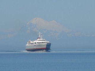


Shot the next two pictures as we left port:
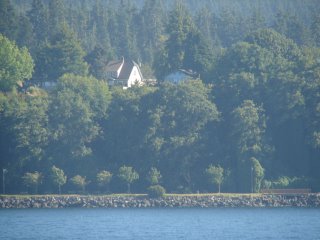


Arrival in Victoria:

I went to Butchart Gardens (*yawn*):

I wasn't overly impressed with Victoria. Not a lot to see, and very many "undesireable" types roaming the streets.

I stayed in Victoria for 2 nights, then drove up the north coast along Hwy 1 to a port town called Nanaimo. The drive up was very pretty, with the highway hugging many lakes. I took another ferry over to the city of Vancouver, which was a huge city on the water. I stayed a few days, and drove around a bit. Didn't do a whole lot of tourist things, although I did go see this giant suspension bridge, called the Capilano Suspension bridge. It was 450 ft across and 230 ft above the river below:

Well, that's about all from this area. Not really that impressive, although the city of Vancouver was very nice.